Construction Progress Monitoring
A measured record of your project, from clearing to closeout. Construction moves faster than the paperwork that describes it. By the time a discrepancy shows up in a pay application or a closeout set, it's a claim instead of a conversation.
Site Capture Program
What We Can Tell You
We capture your site on a set schedule and deliver measured data - not just pictures of it.
Between Any Two Visits
How much material moved between any two visits, in cubic yards
Where grade changed, and by how much
Individual stockpile volumes
How much area has been disturbed, cleared, or stabilized
Where the disturbance edge sits, and whether it moved
On Any Single Visit
Existing grade at any point or along any line
Horizontal position and dimensions of what's been built
Interior dimensions, floor to floor and wall to wall
Position and elevation of installed systems, including structure, walls, and MEP
Clear heights and obstructions above ceiling, before they are closed in
Against Your Drawings
Measured differences between existing and design grade
Quantities in place compared to quantities planned
Interferences between installed systems and what was drawn
Exterior From The Air. Interior From The Ground.
From The Air
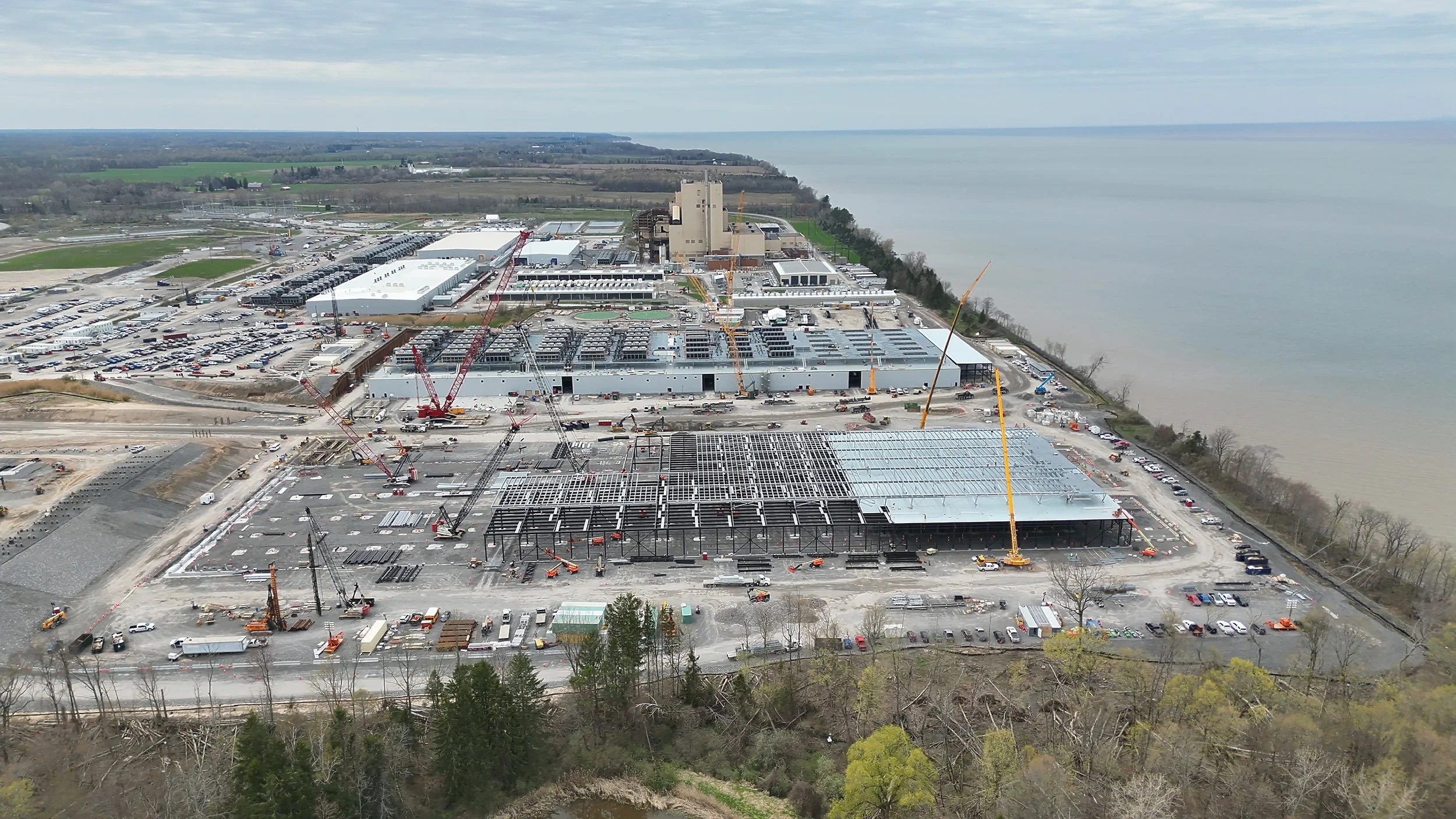
Aerial capture covers the site, the earthwork, the envelope, and the roof.
From The Ground
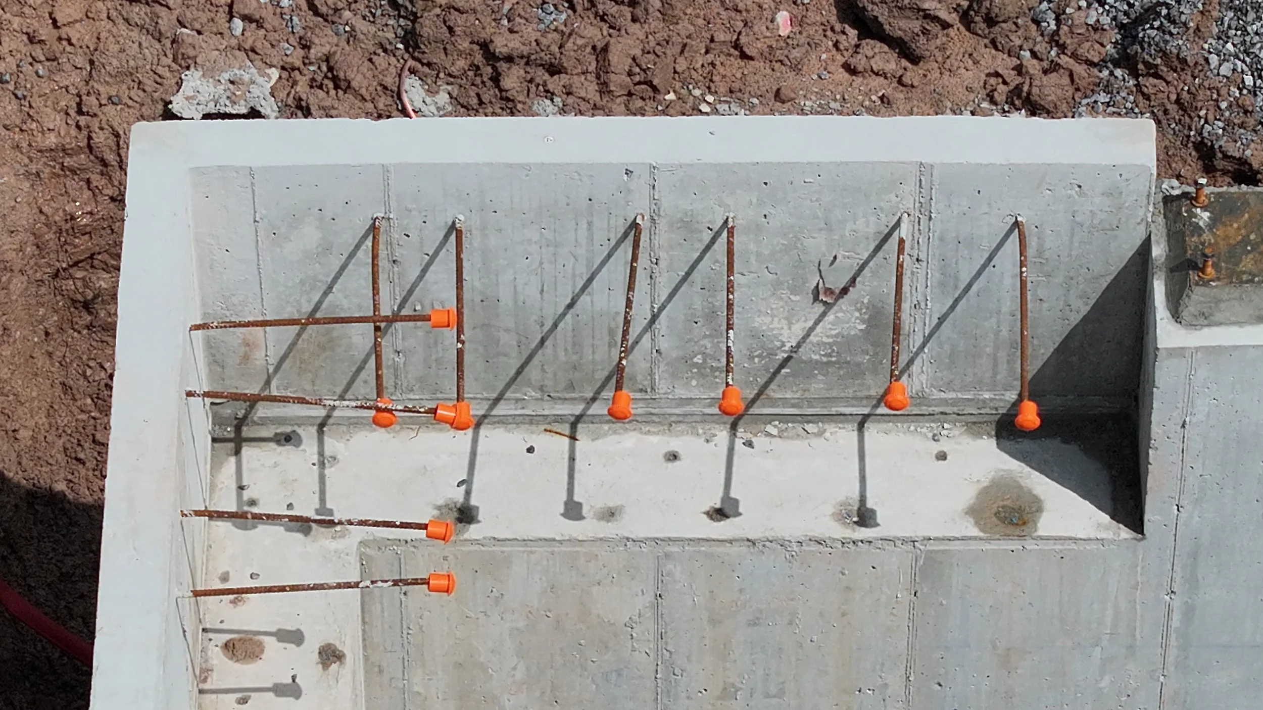
Terrestrial LiDAR covers what’s under the roof - structure, walls, MEP, and finished space - with 360 captures, photography, and video recording the conditions a scan doesn’t show: labeling, connections, workmanship, and what’s about to be covered up.
Everything is registered to the same survey control, so the exterior and interior records are one dataset in one coordinate system.
How A Project Runs
Two rhythms: a recurring visit that tracks change, and milestone captures times to the work.
Before The First Flight
We coordinate with your civil engineer and surveyor to establish ground control: permanent points placed where they won’t interfere with the work, with coordinates provided by your surveyor. That control is what makes every measurement afterward repeatable and defensible.
The Baseline Capture
Before the first machine arrives, we document existing conditions - site topography, existing structures, and the condition of adjacent property. It’s the one visit that can’t be made up later, and it’s what answers
Every visit
An orthomosaic, an orbit video, and still images from fixed positions, on a weekly, biweekly, or monthly schedule to match the pace of the work. Volumetrics and surface comparison against the previous visit.
Before it’s covered up
Underground utilities, conduit, and structures captured in position while the trench is still open. Everyone regrets not having this at the first repair, and it can only be captured in the window between installation and backfill.
At project milestones
Interior LiDAR and 360 capture at framing, rough-in, and closeout, compared against the design model to locate interferences while they're still accessible. Thermal imaging once glazing is installed, again after any envelope remediation, and at completion. At each major phase we register the capture to your design model and deliver the measured differences.
At completion
A final capture of the finished project, interior and exterior, registered and delivered as a record set your facility team can actually use, and drawn in CAD if you want it. It's the drawing set that reflects what was built rather than what was planned, and it's what the next renovation starts from. We also deliver aerial and ground photography and video at topping out and completion.
Capture is not the same as measurement
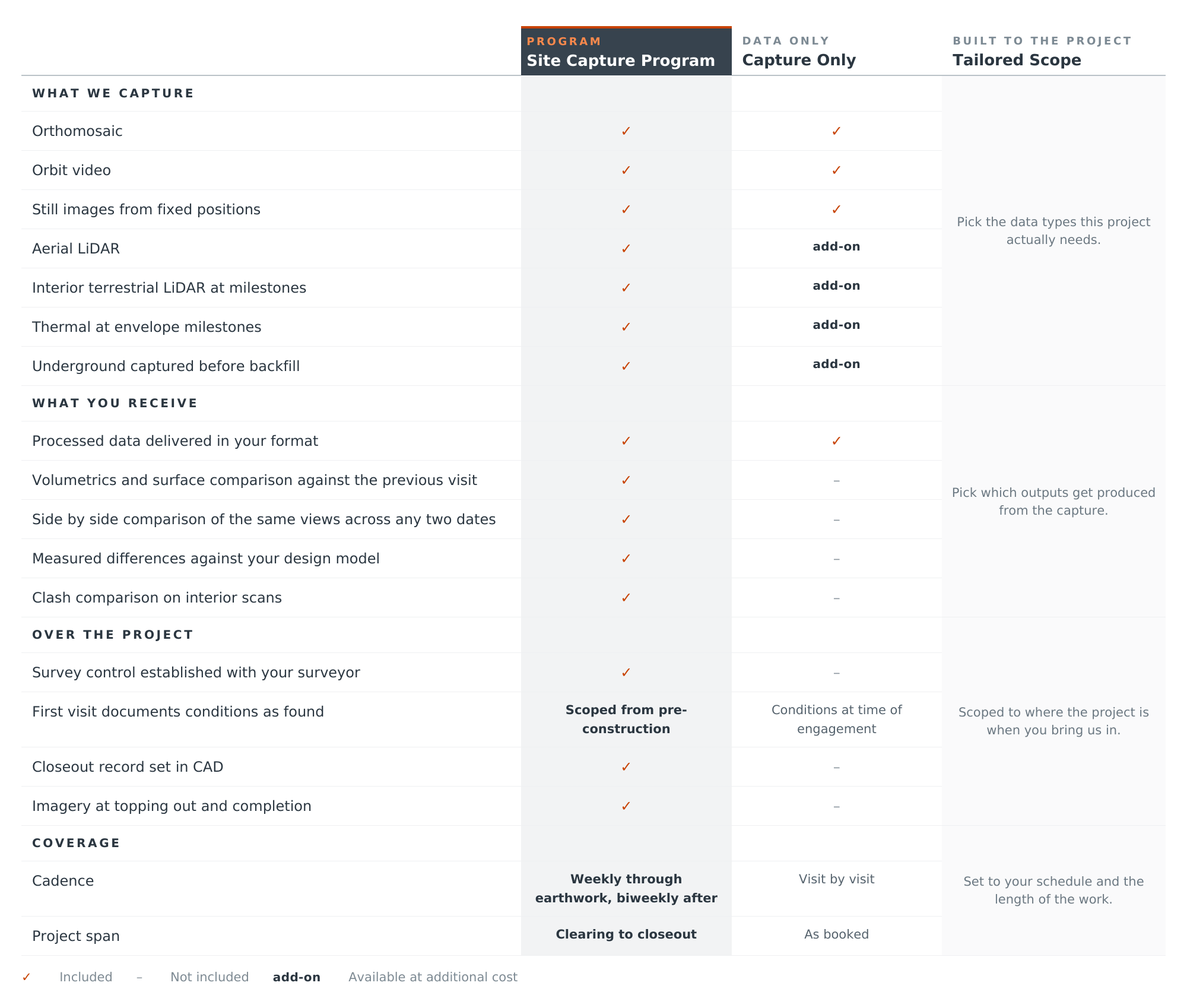
Most drone services sell the capture. You get an orthomosaic, some video, and a set of images, and what those files mean is left to you.
Capture Only is that product, and we offer it because sometimes it is all a project needs. What it cannot do is answer a question. It will not tell you how many cubic yards moved last month, whether the disturbance stayed inside the permitted limits, or how what was built compares to what was drawn.
Those answers come from survey control, repeatable positions, and a drafting department that can register a capture against a design model. That is the difference between the two columns, and it is why the program costs more than a flight.
Why Most Clients Take the Program
The costly part is already paid for
Mobilization, control, access, flight planning, a day the weather cooperates. Those sit in the single service. Every additional data type is captured on the same trip, so the second and third deliverables cost a fraction of the first.
You can’t go back to that day
Conditions change, access comes down, work gets covered. Capturing one data type now and deciding you need another later means paying to mobilize twice.
One control means the data works together
An orthomosaic, an orbit video, and still images from fixed positions, on a weekly, biweekly, or monthly schedule to match the pace of the work. Volumetrics and surface comparison against the previous visit.
The record outlives the report
The report answers today's question. The dataset answers every future one, including comparison, design, renovation, and claims.
Tailored Scope
Tailored Scope starts at the single-service level and goes up. Different coverage, different deliverables, different cadence.
Frequency
Once, at milestones, or on a set cadence.
Extent
Which areas, which elevations, which portion of the site.
Accuracy
Whether survey control and independent verification are required.
Format
Raw data, registered data, or drafted output in your CAD environment.
Combination
Any services from any package, assembled for the project.
Working with Your Team
We work alongside your project team. Engineers, architects, surveyors, contractors, and construction managers all get better information to work from, and nothing we deliver takes the place of what they do.
We measure. Your engineer of record, architect, and surveyor interpret. Our deliverables are built to go straight to the people already responsible for the design and the compliance calls.
The test for anything we write: could someone go up there with a tape and check it? If yes, it is ours. If it requires judgment, it is theirs.
Bring your own engineer, or we can introduce you to one
Most projects already have a structural engineer, envelope consultant, or architect in that seat, and our deliverables are built to land on their desk in a format they can work from the day they get it. When that seat is empty, we can put you in touch with firms we work with regularly who already know how to read what we produce. They engage with you directly and we take no fee or markup on their work. We stay on the measurement and they stay on the interpretation, which is what keeps both of them worth anything.
Limitations of use
Deliverables are aerial and terrestrial measurement products. They are not a boundary survey, not a topographic survey certified by a licensed land surveyor, and are not intended for establishing property lines, easements, or legal descriptions.
Accuracy is stated per deliverable. Where results will be used for design, permitting, regulatory submission, or determination of contractual compliance, they should be reviewed by your licensed surveyor or engineer of record.
Observations are those identified within the area captured, on the date captured, under the conditions recorded. Areas not visible to the capture are listed with each delivery.
DronePoint provides construction progress monitoring for surveyors, engineers, contractors, and property owners across New York, Pennsylvania, Ohio, and New England. Our capture work is processed in-house by Professional Drafting Service, the drafting firm behind DronePoint since 19887 – so what you receive is a finished, usable deliverable rather than a raw data dump you have to hire someone else to clean up.
Deliverables are provided in the formats and coordinate system your project requires.
Tell us about your site and we’ll come back with a scope and a price. Call 716-447-9698 or request a quote.