OUR SERVICES
Drones allow us to access normally inaccessible spaces like multi-story buildings, hazardous areas, rooftops, etc. while providing valuable information for construction, maintenance, development, engineering, real estate, and more. While Google and Bing maps may provide some helpful information, they can be outdated, leaving you with inaccurate data. Utilizing our drone services means you will have access to current, accurate, high quality images. Plus, whether you're local or out of the area, our repeatable autonomous flight plans allow you to monitor progress or changes on your schedule — and we're willing to travel to make it happen.
Available Service Offerings
-
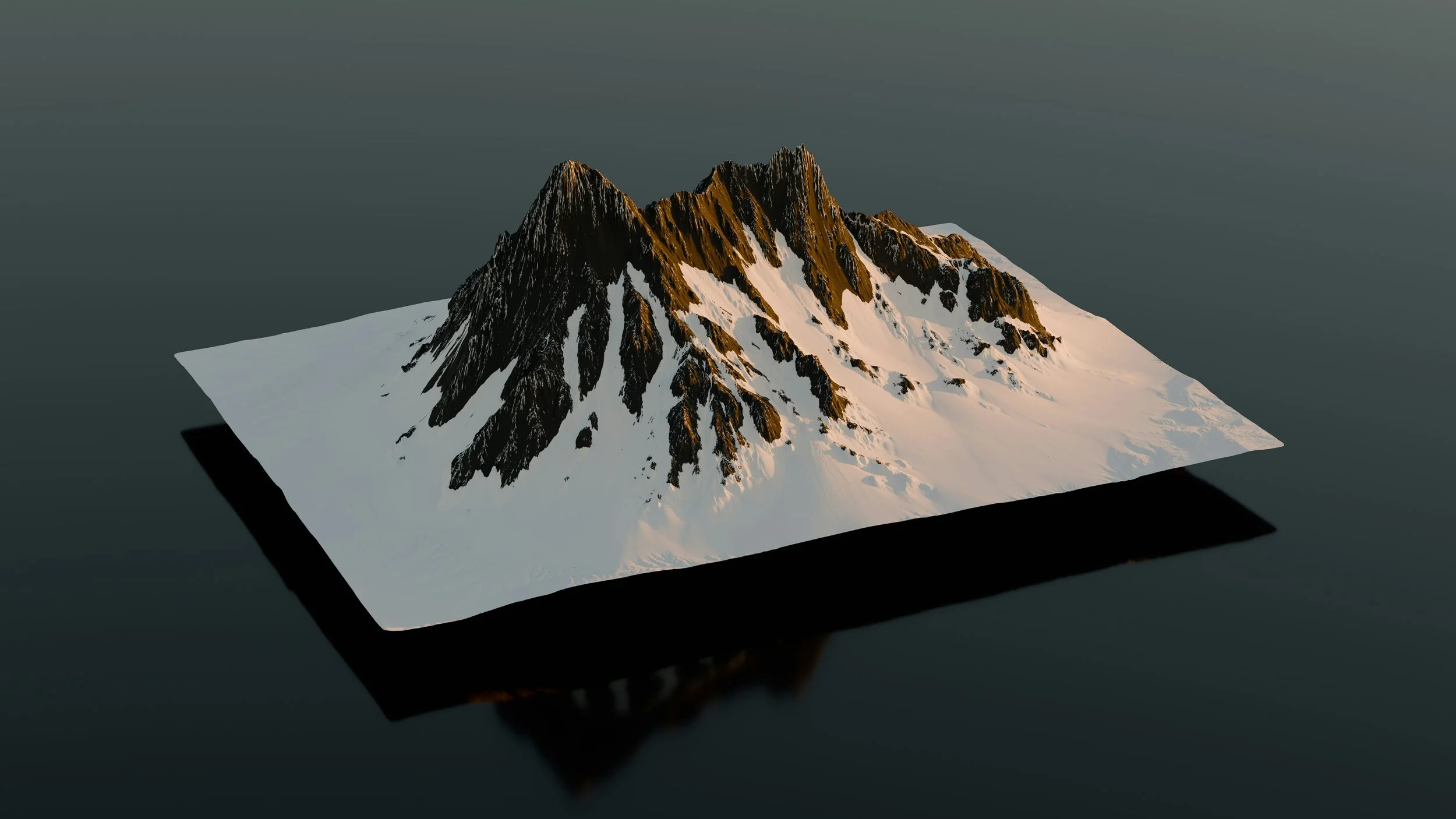
Aerial LiDAR Scanning
Our cutting-edge drone services harness the power of aerial LiDAR technology to provide unparalleled accuracy and detail in aerial surveying and mapping. By emitting rapid laser pulses, our LiDAR-equipped drones create precise 3D models of landscapes, structures, and terrain, offering invaluable data for various industries including construction, agriculture, and urban planning. With our state-of-the-art aerial LiDAR scanning capabilities, we deliver high-resolution, georeferenced point clouds that enable informed decision-making and streamlined project management.
-

Photogrammetry
Whether you need a basic overview or a comprehensive detailed aerial site map, we capture every angle of your project with our drone services. We provide high-resolution, up-to-date imagery and topographic data, turning it into accessible maps that are ready whenever you need them.
-

Construction Progress Monitoring
From the first groundbreaking to the final touches, we capture every stage of your construction project with our drone services. High-resolution aerial images and videos provide an up-to-date visual record of progress, allowing you to track milestones, monitor timelines, and ensure quality control. All your construction progress data is organized, archived, and easily shareable, so you stay on top of your project every step of the way.
-
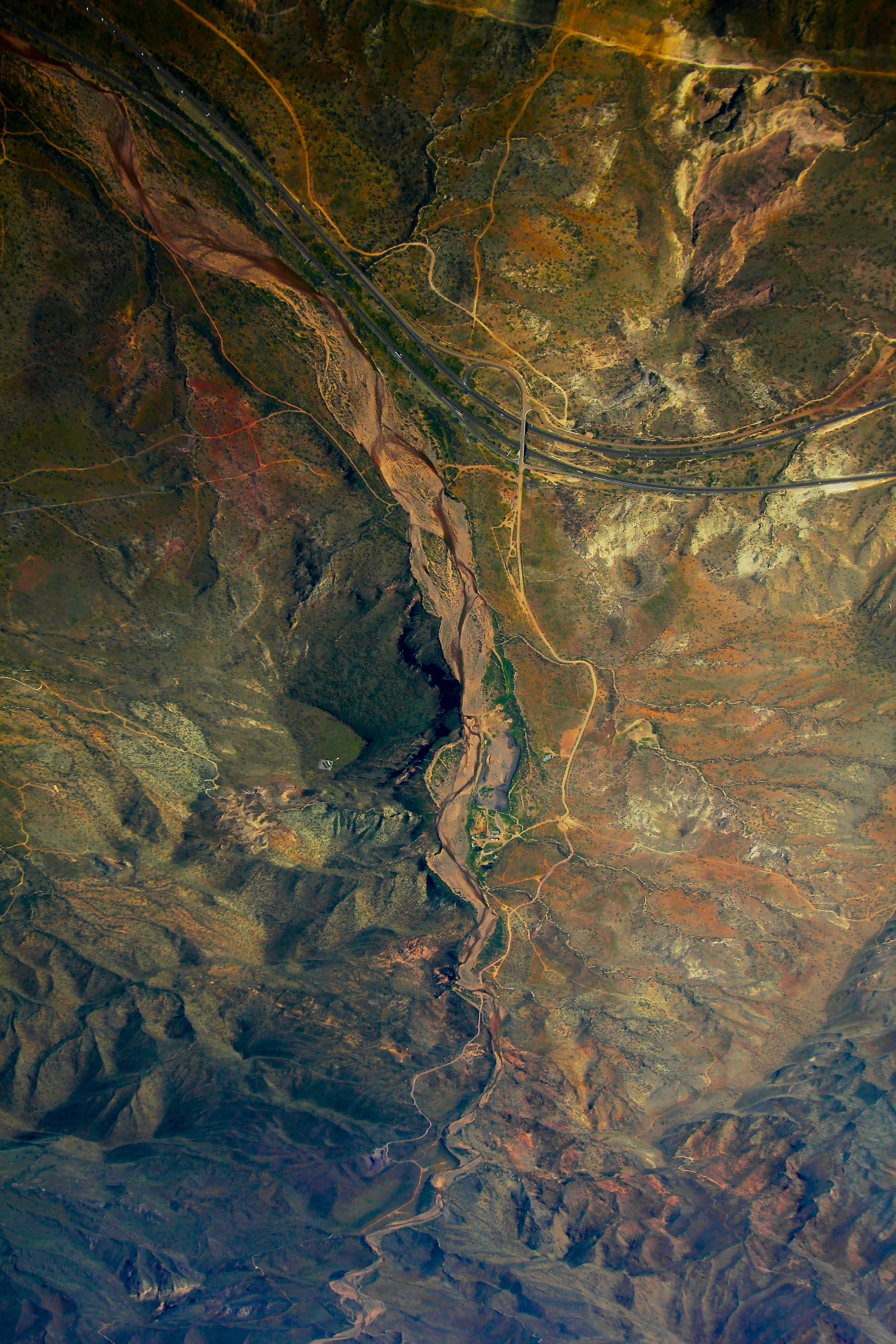
Topography Maps
Detailed representations of the land's elevation and features help you better understand the terrain and make informed decisions. Using advanced mapping techniques, we deliver accurate, high-resolution maps that highlight slopes, contours, and natural features, perfect for development, construction, and land analysis.
-
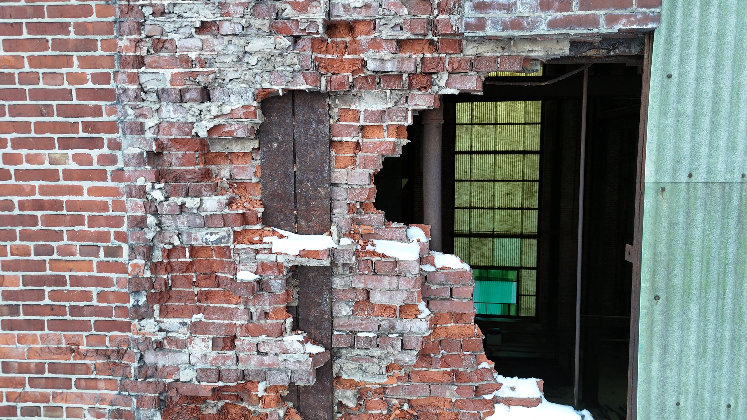
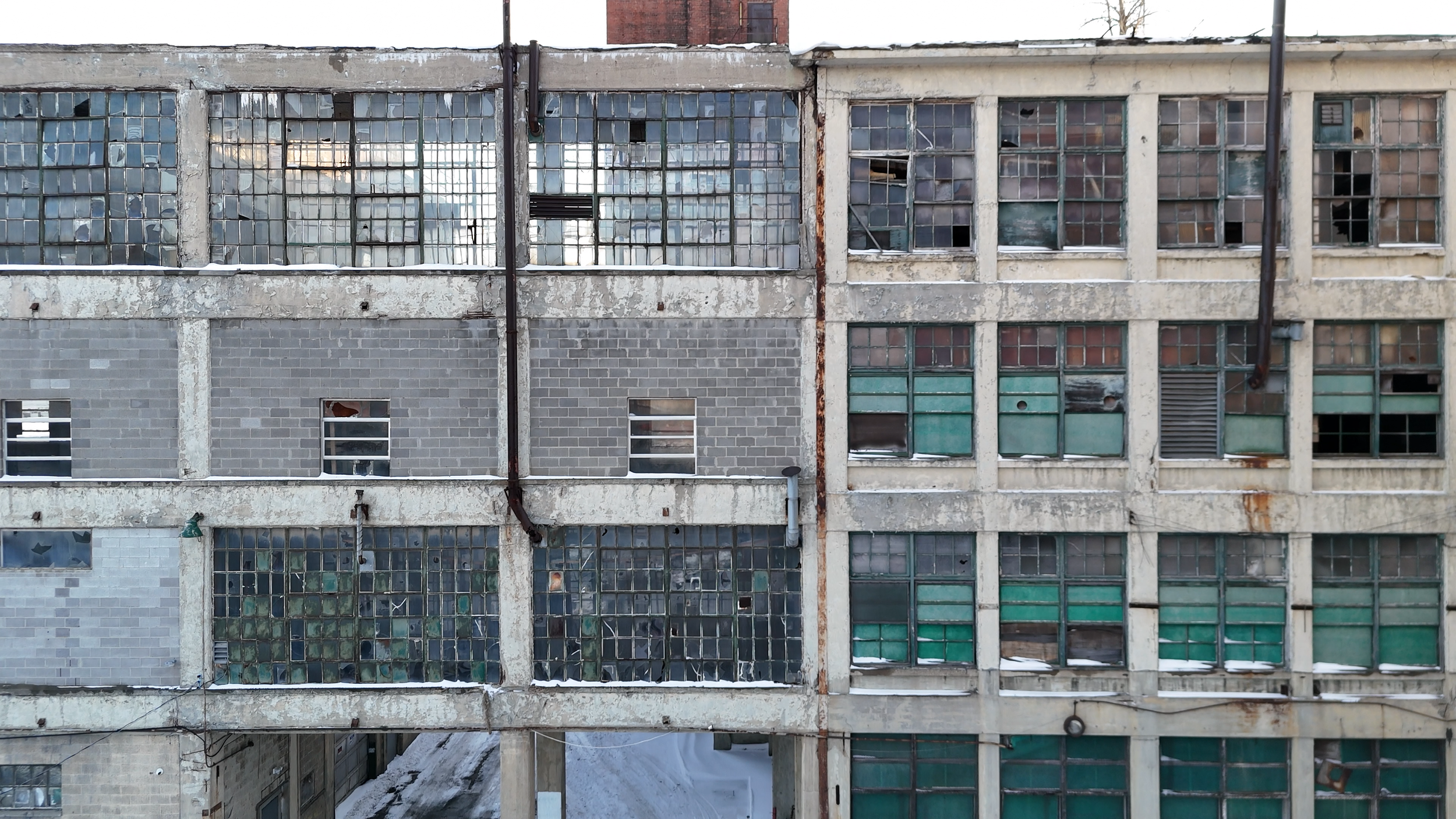
Brick/Façade Documentation
Brick and Façade using drone technology captures high-resolution imagery and precise measurements of building exteriors. This data is then processed into accurate 3D models or detailed construction drawings, ensuring a higher level of precision for your project. Whether for inspections, renovations, or new developments, our drone services provide the essential visual and spatial data needed for a more accurate and efficient process.
-
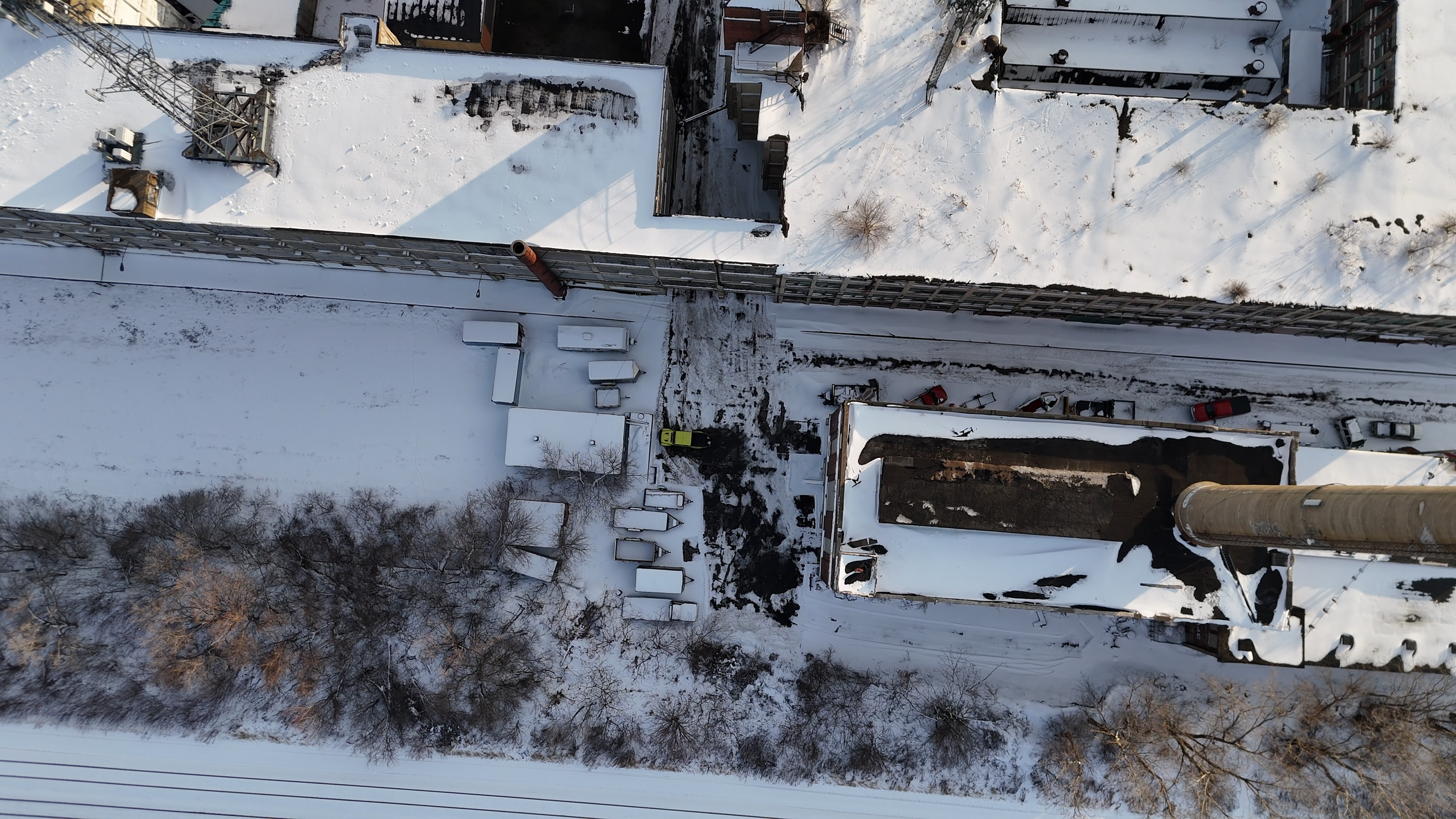
Roof Documentation
Roof Documentation has become an part of modern construction and inspection. Every detail, from the roof's structure to its intricate features, is crucial before starting any work. Our drone services provide precise measurements and high-resolution imagery to ensure the project is planned out to perfection, taking it to the next level of accuracy and efficiency.
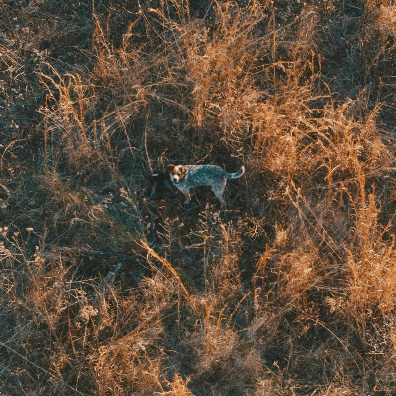
DronePoint is also able to assist with lost pet recovery utilizing our thermal drone to search large areas more quickly and effectively than can be done via ground search.
Contact us if you are in need of assistance in finding a lost pet.
Fly With Us
Additional Services
CAD Drafting | 3D Rendering | LiDAR 3D Scanning | 3D Modeling | CAD Graphics
Our sister company, Professional Drafting Service, provides comprehensive architectural design and drafting solutions from initial concept and design development to construction and close out documents.
Contact us
Serving Western New York and Beyond. Based in Buffalo, NY, DronePoint provides LiDAR and 3D laser scanning services throughout Western New York and across the region. We travel to serve clients in Rochester, Syracuse, Albany, New York City, Pittsburgh, Cleveland, Erie, and surrounding areas. No matter where your project is located, we're ready to bring our scanning capabilities to you. Contact us to get started.