
Floodplain Mapping
Client
Genzel Land Surveying
Project Overview
Genzel Land Surveying was engaged to support a contractor planning the construction of three new residential homes. To meet local municipal requirements, the contractor needed confirmation that the proposed building sites were not located within a regulated floodplain. This required a detailed topographic map of an approximately 40-acre site, clearly illustrating existing ground conditions relative to the mapped floodplain boundary.
Traditional surveying methods were possible, but site conditions and scheduling constraints made them inefficient. DronePoint was brought in to provide a faster, cost-effective solution using UAV-based LiDAR, photogrammetry, and civil drafting services.
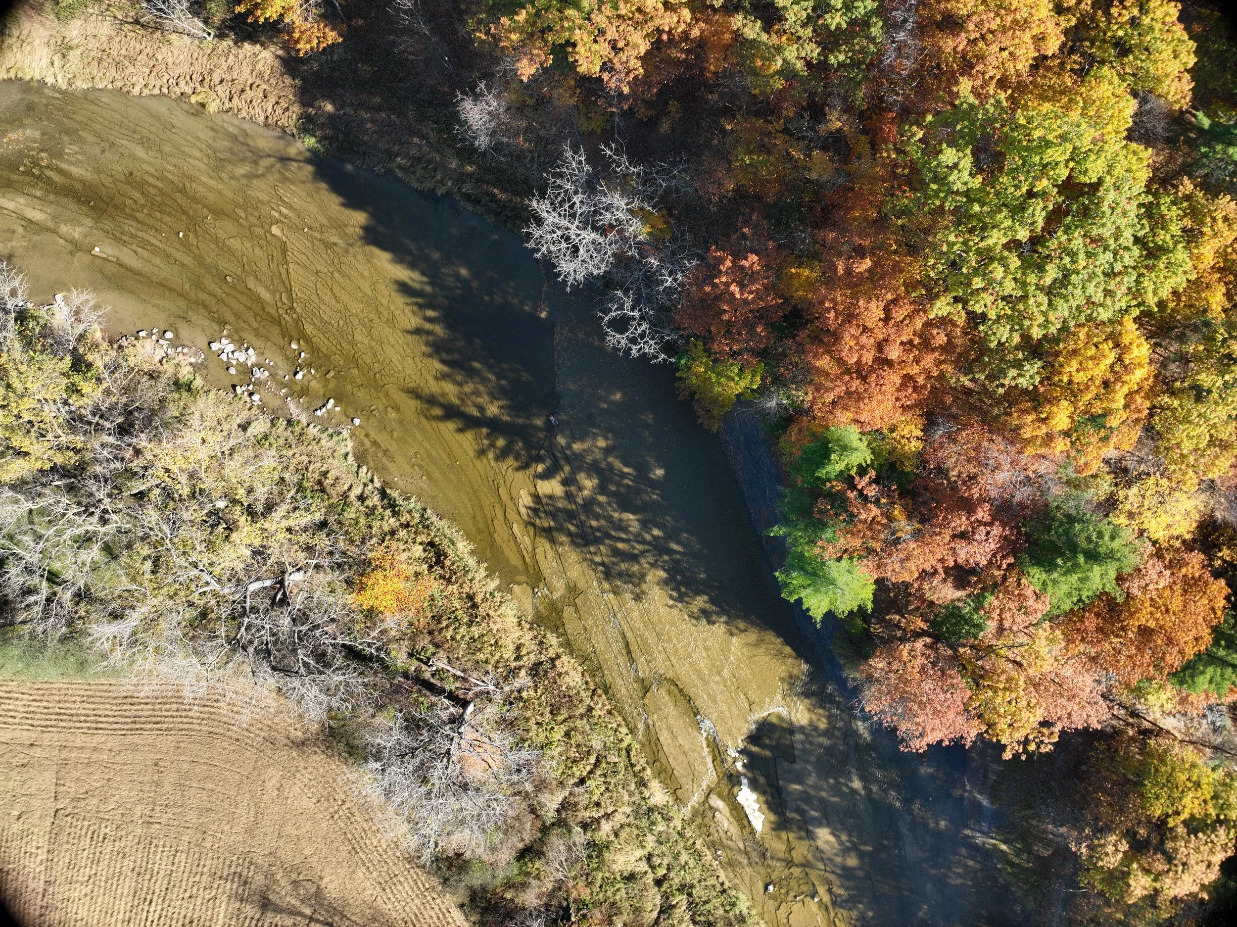
Aerial photograph captured by drone depicting a creek traversing the property.
The Challenge
The primary challenge was producing accurate, municipality-ready topographic data for floodplain verification within a limited timeframe.
Key constraints included:
A 40-acre site with noticeable elevation change
An active wheat field that limited efficient ground access
Time-sensitive review and permitting requirements
The need to clearly demonstrate that three proposed home sites were outside the floodplain
Relying solely on conventional ground methods would have increased field time, office processing time, and overall project cost.
Why a Drone-Based LiDAR Approach
Genzel Land Surveying selected DronePoint based on prior successful collaborations and confidence in the quality of deliverables.
Additional factors included:
Competitive pricing well within budget
Rapid mobilization to the site
Fast turnaround of usable deliverables
Demonstrated expertise in UAV and LiDAR technology
Our Approach
DronePoint worked as a seamless extension of Genzel Land Surveying’s workflow.
Our approach included:
Coordinating data requirements and scope in advance
UAV LiDAR and photogrammetry data collection across the full 40-acre site
Processing and validating terrain data
Civil drafting to integrate topography with floodplain mapping
This approach minimized time in the field while maximizing accuracy and usability of the final deliverables.
Deliverables
DronePoint provided a complete, ready-to-use dataset, including:
LiDAR-derived topographic surface
High-resolution ortho-mosaic imagery
Civil drafting deliverables in DWG format
Floodplain boundary overlaid directly onto the ortho-mosaic and topography
These deliverables allowed for quick municipal review and confident decision-making by the contractor.
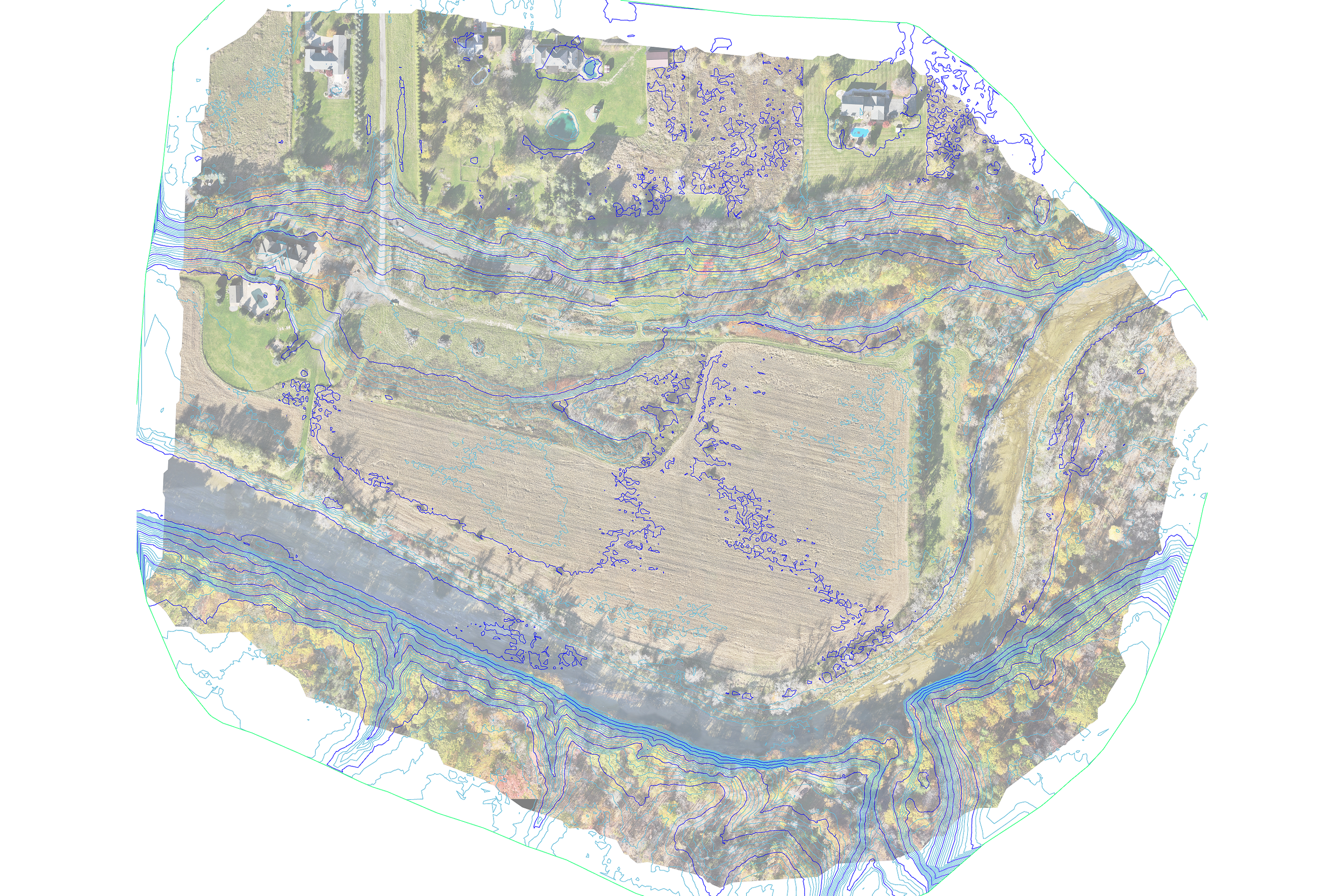
Contours overlaid on the orthomosaic image to enhance clarity and visual interpretation.
Results & Impact
The UAV-based solution delivered clear advantages over traditional surveying methods:
Time savings: Reduced both field and office time compared to conventional approaches
Cost efficiency: Lower overall project cost by minimizing labor-intensive ground surveying
Improved workflow: Allowed the surveyor to focus on boundary and legal surveying
Faster approvals: Information delivered ahead of alternative methods
Client Outcome
The contractor was able to proceed with confidence, knowing the proposed homes were located outside the regulated floodplain. For Genzel Land Surveying, the project delivered meaningful operational benefits.
Conclusion
This project demonstrates how UAV LiDAR and photogrammetry can streamline floodplain mapping for residential development. By replacing time-intensive ground surveying with aerial data collection and integrated drafting, DronePoint helped reduce costs, accelerate schedules, and improve workflow efficiency—while maintaining the accuracy required for municipal approval.
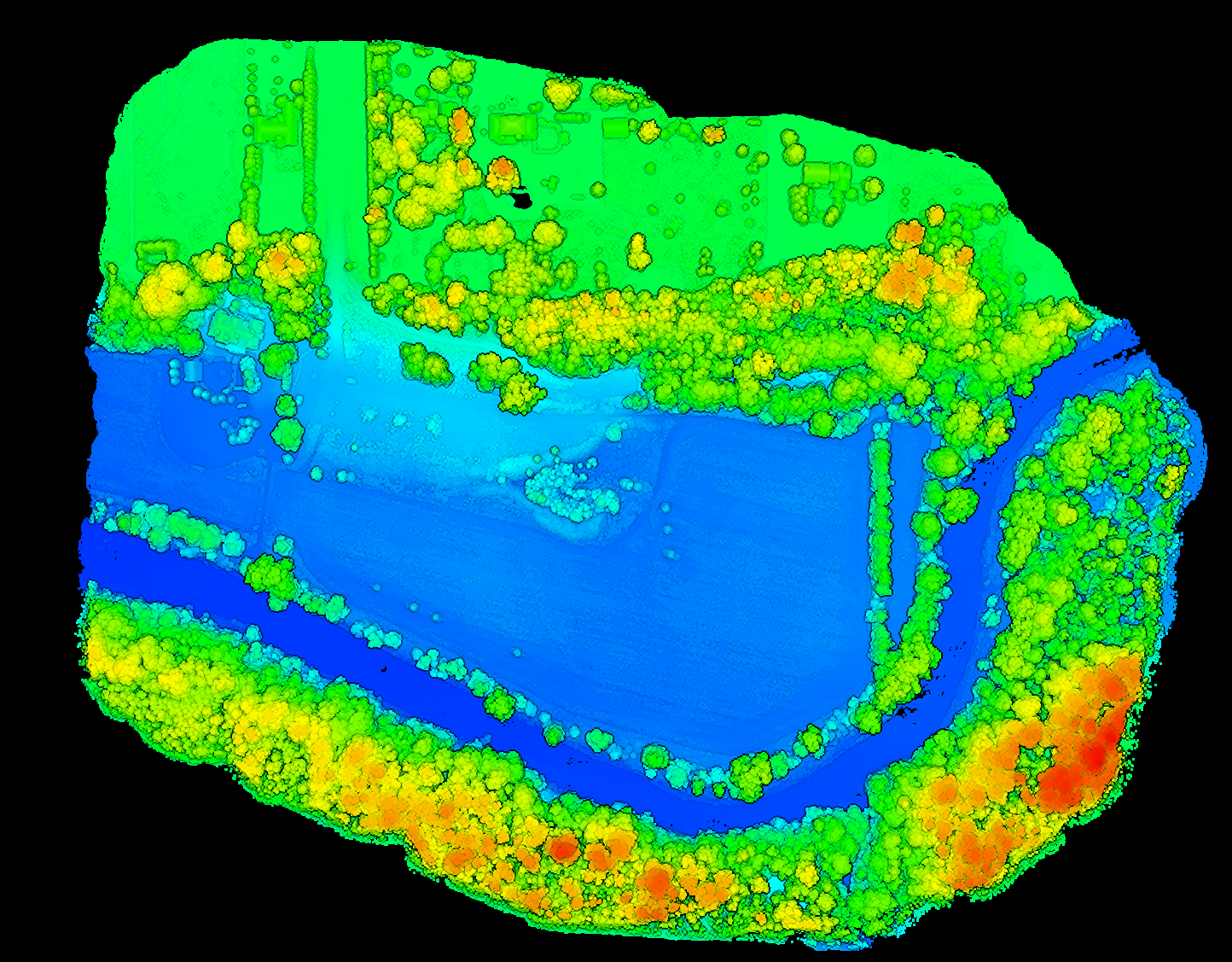
Digital Elevation Model (DEM) of the project site